While I was studying at the University of British Columbia I chanced to notice a magazine on display in the Campus Bookstore. The top caption on the cover page of that magazine was the lead to an article about the newly created Bruce Trail in Ontario. Many years later I was living in Toronto and had the opportunity to join a hiking group. The 'Hike Master' was Jack Candido whose avocation is hiking For a few summers I went on a number of hikes that he conducted on and around various segments of the Bruce Trail.
In Ontario there is a ridge which begins somewhere in the United States and extends all of the way north to the tip of the Bruce Peninsula which juts out into Lake Huron. Indeed, it is this very ridge that causes Niagara to 'fall'! The head of the Bruce Trail is near the marker at Queenston Heights (a battle field from the War of 1812 and a short distance from Niagara Falls) and continues the few hundred miles to its termination near the town of Tobermory. I understand that the trail was built and is maintained largely by volunteer labor on the part of hikers and others who live near the route.

As well as the Bruce Trail, there are a number of other trails which crisscross and go in circles, thus the trail is accessible from almost anywhere along the route. Our hike master knows where all of these trails are located and, in the spring after the snow has melted, he and a couple of friends will map out hikes to be covered by the Out and Out group during the summer season.
As I mentioned in the blog about the Paris hike, automobiles are driven to the chosen trail head and parked and the walk will bring everybody back there at the end of the day. Most of those hikes are relatively short although I noted that one was more than 18 km in length.
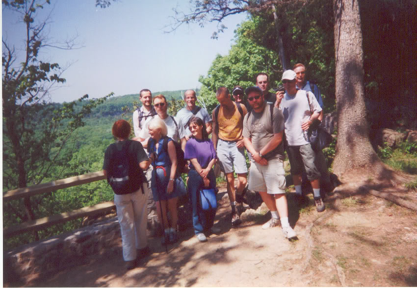
The Hiking Group
Rattlesnake Point is a park near the outer suburb of Milton and it is a very popular place for visits, picnics and camping. Our goal was to reach Crawford Lake which is on the far side of the steep - and relatively broad - Nassayawega Canyon in the bottom of which is a creek of the same name.

View across Nassayawega Canyon to the farmland on the other side.

Beside the lookout point were a group of young men rappelling on the cliffs.
Across the valley is Crawford Lake - a small body of water that is fed by underground springs. At one time there was a mill beside the lake - owned by people named Crawford - now that lake is a part of the park.
Some years ago a group of students from a nearby university decided to 'sound' the lake. When the water that they had collected was analyzed, corn pollen was identified at around the 100 foot mark. That meant that corn must have been cultivated nearby a few hundred years ago. The indigenous people who were known for agriculture were Iroquois so the surrounding woods were scoured. Sure enough - the remnants of a fire pit plus stone tools were discovered as well as the outline of where a small village must have stood.
The village has been recreated - complete with tepees - and it is an Educational Center and an Historical Site. I have been there two or three times and, on the last visit, an educator was in the tepee with a group of school age children. We adults who were there were permitted to wait in the background and to listen to the lesson. It was fascinating.

I was unable to take any photographs of the Iroquois Village. This shows where we ate our lunches nearby.
Near Milton is the bedroom suburb of Georgetown and, just north of there, is the hiking trail known as Terra Cotta. This hike was in the shape of a gigantic square and, while much of it was along paths in the woods, a good part of it was along local roads as well.

A Woodland Pond

Woodland Creek
What was fascinating about the latter was that the houses - modern ones - were huge and the occupants of many of them were flying an Italian flag. Was this Mafia territory?
Also this hike exhibited how some of the land claimed for the Bruce Trail is still under dispute and, at one spot, the route had been changed so that we did not walk on land that had been claimed as 'private'.
There were two places where wild flowers were seen in abundance.

Trillium's which grow, as well, in the damp forested areas of Coastal B.C. As they usually blossom around Holy Week, they are known there as 'Easter lilies'.

A field of marsh marigolds.
No comments:
Post a Comment