As well as the main rivers (the Rouge, the Don and the Humber) there are creeks too. The creek that has the most developed parkland along its valley is Etobicoke Creek which is a mile or so west of the Humber River. For much of this creek it is a gentle stream but, during a sharp storm of a few summers past it became a raging torrent. A family that lived near its source lost a small child to the stream - he was too curious, got too close to the bank and was swept away.
One should treat all waterways with respect as Mother Nature can be wrathful at times!
I began my walk in a large park (Centennial) which is near the source of the stream.
'Little' Etobicoke Creek
As I have mentioned in a previous blog, Toronto is situated on a relatively flat plain on the north shore of Lake Ontario so, unlike Montreal, Calgary and Vancouver, there are not any natural skiing hills nearby. What to do? Create one! Actually, there are two in Toronto and I walked past one of them near where I shot the above photo.
Near that point there is a conservatory and the following photos were taken in there.
A 'donkey' is now a pot in which to grow cacti
A cactus garden
Some budgerigars
An unusual plant - it looks similar to a fungus!
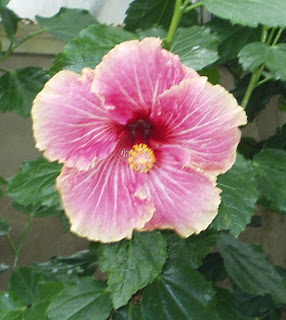
A hibiscus?
I love the vividness of the color in this flower (hydrangea?)
I do not know which 'goddess' this represents - do you?
An artistically placed fountain with lily pads
Near the conservatory is this artfully created rose trellis (a 'snake' or 'split rail' fence)
Also, in that part of the park, is a large pond.
In the background are a pair of mallard ducks. The drake very nicely swam to the edge of the pond so I could shoot the following photo.
Etobicoke Creek near Centennial Park
The creek quickly grows in size
A tributary creek - and evidence as to how large it can be!
There had been a storm on an evening or two before I enjoyed this hike and the above is an example of the damage done.
Reflections in the creek are pretty.
Further down the creek I passed this weir.
Not far from the weir I came upon this neighborhood park.
At one point the path left the bank of the creek and passed through this grove of trees (the following photos).
Another photo taken in that grove
A little waterfall
The subway line crossing Etobicoke Creek near Islington Station
Etobicoke Creek about to flow into Lake Ontario
From the mouth of Etobicoke Creek looking east towards downtown Toronto. Just to the right of center is the CN Tower. Due to the distance from where I was standing, it is hard to see.
No - these are not all of the photos that I shot on that hike. The remainder will stay in the file!


No comments:
Post a Comment