Friday, 6 September 2013

Vancouver's Stanley Park

Throughout the 19th and the first half of the 20th centuries the British monarch was represented by a British Royal or Noble who assumed the role of Governor General. It was his - or her - task to sign all legislation into law through the debate and vote of the Parliament of Canada . Towards the end of the 19th Century the Governor-General was Lord Frederick Stanley, 16th Earl of Derby. While many Canadians (including myself) could not name most of his predecessors - nor those who came later - we know and remember his name.

I would say that practically all Canadians know of Lord Stanley's Cup - the symbol for supremacy in the game of ice hockey.

Also, the citizens living on the West Coast are familiar with the isthmus of land extending northwest from Vancouver's West End  to a bridge connecting with North and West Vancouver. That isthmus is named Stanley Park and is the 'crown jewel' of the magnificent setting of the city.

Vancouver - In the foreground is the Cruise Ship Pier and - in the upper right - is the isthmus that is Stanley Park


Growing up in the Fraser Valley I was familiar with Stanley Park and eagerly looked forward to summer excursions there for visits to the zoo and picnics. Many years later I lived in the West End and enjoyed many a walk into the park and, especially, into the forests that clad much of the area.

From the very early days of settlement, West and North Vancouver were linked to the city by ferries then, during the 1920s, the Lions Gate Bridge was built as well as a causeway allowing vehicular traffic access to the city.

A causeway through that beautiful park would seem to be a shame but the roadway encroaches upon only a small area when compared to the total acreage of the park.

The Lions Gate Bridge at dusk - Stanley Park to the left and North Vancouver to the right.


The Vancouver end of the bridge is at Prospect Point and, to the east, is Brockton Point where there is a cannon which is fired every evening at 9:00 PM. The cannon points across Coal Harbor and eastward along Burrard Inlet. Naturally, real canon balls are not used in that gun but the sound of the 'BOOM!!!' can be heard for miles. For many a child within earshot - and especially on summer evenings - that is the signal to come inside the house and to get ready for bed.

Near Brockton Point is Malkin Bowl and, during the summer months, musicals are presented from the stage. When I was a teenager I attended a number of those performances. Not only do the cast members have to contend with the sound of the cannon but, also, the 'barking' that the sound of the cannon illicits from the seals in the nearby zoo.

One summer - during the 1950s - there was a lot more rain than usual. During that particular summer Alda and I were enrolled in swimming lessons in a park in New Westminster. Due to the inclement weather, both our swimming lessons and the performances at the outdoor Malkin Bowl were cancelled.

Vancouver city transit service to the park terminates at a loop beside the downtown entrance. While there are vehicles which take visitors further into the park, most people walk across a viaduct which spans an estuary that is named Lost Lagoon.

                                                             
Lost Lagoon, Stanley Park with the north shore mountains in the background. This - and many of the other photos which I will display - are thanks to the generosity of Michael W. who lives within walking distance of the park. Also, I am posting a few photos from my personal collection - you will notice the difference in the quality of the images!

                        A view from the opposite side of the lagoon to the West End towers

While I lived in the West End of Vancouver, the only creatures inhabiting the lagoon were water birds. However, Michael has shown me that now there are others. 


                                                               Some tortoises

I do not intend to offend those who lived there first so here is a photo of some mallard ducks.


A walk which I enjoyed more than once is the seawall which completely encircles the park - but down by the edge of the water. The length of that walk? Seven miles! At high tide the gentle waves lap the side of the seawall while, at low tide, there is the aroma of salt water and of seaweed. When wearing sturdy footwear one can scramble over the rocks and look for minnows, kelp and little creatures like sea worms - not to harm but just to look (besides, sea worms have pincers which do hurt if used upon a finger!). Mussels and kelp do not have the ability to pinch - they just smell wonderfully of sea water.

Beginning at English Bay - or at Coal Harbor - one can walk to the other end in a couple of hours.

English Bay Beach looking around to Second and Third Beach. Where the residential towers end is where Stanley Park begins.

On the southeast side of Stanley Park is Coal Harbor with marinas, more condominium towers and a sea plane base - one can (or could) fly from there to the Inner Harbor in Victoria or to Nanaimo.

                                                                   Coal Harbour

This photo confused me when I first looked at it - and then the penny dropped - this is the Vancouver Rowing Club. In my orignal text I erred by identifying this as the Royal Vancouver Yacht Club as well but the latter is at some distance from here. However, some members of the Yacht Club do moor their boats near here. The following is a photo  of their moor-age. I wish to thank Victoria for pointing out my error to me - and to thank Michael W. again for the following photos. 


                                                       The Vancouver Rowing Club                    

                   Moor-age for boats belonging to members of the Royal Vancouver Yacht Club


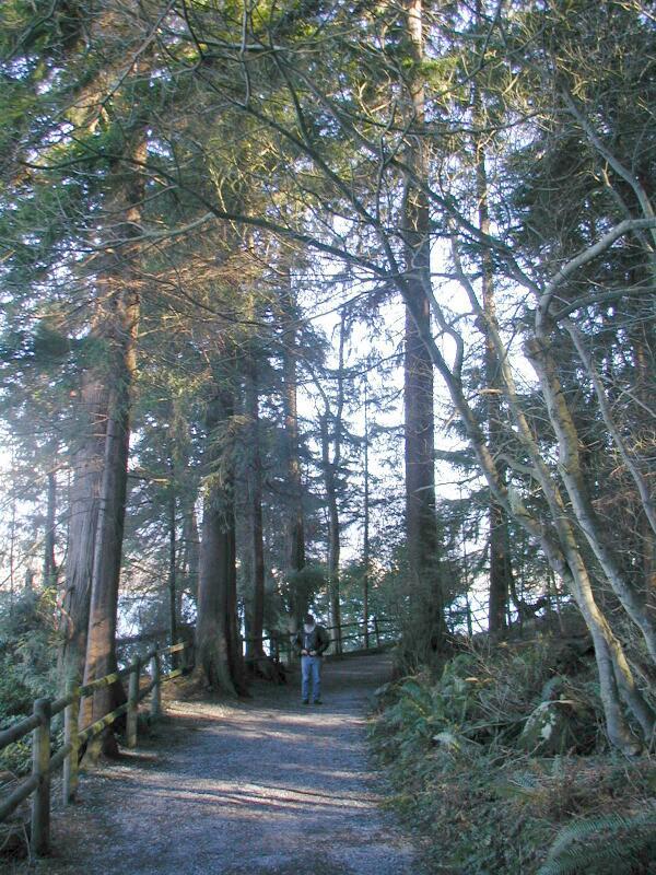
Earlier in this blog I mentioned the forested area on the west side of the park. The following are photos of the well-maintained trails that pass through there.

               One of my photos taken by Ric when he and I visited Stanley Park in February 2002

Another photo which was taken by Michael.


Below where we were when the photo of me hiking along the trail was taken is Siwash Rock - sacred to the First Nation peoples.

                                                                
Siwash Rock. The promontory seen in the left background is Point Grey - the site of the campus of the University of British Columbia


 A cruise ship leaving Vancouver probably on its way to Alaska. In the background is West Vancouver and Hollyburn Ridge which is one of the local ski locales.

 
The boundary of West Vancouver - left - and North Vancouver - right. The bridge in the left foreground is crossing the Capilano River and, near there, is the reservation of the Capilano First Nation. For you movie buffs - that was the home of the late Chief Dan George who received an Academy Award nomination for his role in the movie "Little Big Man".

                                              The totem poles standing at Brockton Point

A single totem pole. This art is NOT whimsical but tells a legend from the First Nation culture.

At that point we encountered another visitor - only it was not there to view the scenery but to beg for food.

Instead of retracing our steps along the trail, we cut across the park and, by so doing, we went past the Stanley Park Pavilion.

The Stanley Park Pavilion which is the site of High School Proms, wedding receptions and other celebrations.

The Pavilion is set in beautiful formal gardens - and the following are a brief look at them.

                         Obviously this photo was taken during a visit in the Spring - tulips!

                             The gardens with some of the West End towers in the background

This final photo looks like it was taken at a Westin Hotel and not in the park but because of the vivid colors, I am adding it.

                                         
                        Stanley Park - I hope that I can revisit there in the not too distant future!


Thursday, 22 August 2013

On to U of T (The University of Toronto)

I think linearly so - when I approach a subject that is not linear I can be lost momentarily.

When I set out to walk to the U of T campus I follow a set route (along St Mary Street, across Queens Park past the statue of King Edward VII, through an underpass under Queens Park Circle West and up a slope along Kings College Circle to Convocation Hall). However, if I follow that here I would be skipping photos and comments that I want to share.

So - if I turn south at Queens Park Circle to Wellesley Street West I am taking a short detour but passing other interesting sites. First is a photo taken along one of the neighbouring streets during an autumn walk.    


As I approach Queens Park there is a statue of Queen Victoria among other statues depicting some of the prominent men of Canadian politics during the nineteenth century.

                                 Queen Victoria on guard in front of the Legislative Building

As you may have noticed, this walk was in the autumn and near the representative of the monarch were these trees and shrubs effectively obscuring a view of Queens Park.

Looking south from the front of Queens Park is a view of University Avenue. The wall of windows on the right is the Toronto Hydro Building. The two larger buildings past the Hydro are the Princess Margaret Cancer Hospital and Mt Sinai Hospital. Across the street from those two hospitals are two more - Toronto General and then the Hospital for Sick Children (colloquially known as 'Sick Kids').

The statue seen in silhouette is of Sir John A. McDonald - one of the Fathers of Confederation.

Returning to the north side of the Legislative Building is the underpass beneath Queens Park Circle West. Continuing up the slope is the common and, on the other side, Convocation Hall.
Limos like the white one are a common sight during Convocation Week. If this had been then there would have been a large marquee tent in front of where I was standing in order to take the photograph.

As I walk up the slope from the underpass across another common is King's College.

To the west of Kings College is Knox Hall - the Presbyterian enclave.


A few blocks further west is the new Jason Robards Library. Recently I was reading an article in a magazine where I happened upon something written by an American who had conducted some research at this library and claims that it has one of the most extensive collection of historical books and documents to be found on this continent.

                                        The new Jason Robards Library on the U of T campus.

As I close I am sharing photos of a romantic lane on the campus - Philospher's Walk. There are three photos.


If you visit the University of Toronto Campus look for this pathway to the northeast of King's College.
If you approach the campus by walking west along Bloor Street to the west side of Koerner Hall (Toronto School of Music) it will be on your left.


Tuesday, 20 August 2013

My Toronto Neighbourhood


In my blog about moving to Toronto I did describe - and posted some photos of - the city.  This blog is about the neighbourhood where I have lived for the past 17 years. With my initial blog I did post a photo of the building in which I live. As that photo is not clear, I am posting another here.

I live in the shorter of the two buildings in the foreground (the one in front of the white condominium building) and on the third floor of twenty (each floor has twelve apartments). I live in a bachelor of which there are two on each floor. My view is east and - as my unit is towards the south end of the hallway - much of what I see is the other building. However, when I look down I see the plaza the southern end of which faces St Mary Street - a short cut to the University of Toronto as well as two church based colleges and, therefore, a very busy pedestrian route.

Probably the best known intersection in Toronto is where Yonge and Bloor Streets cross each other. My residence is one block west of Yonge and an equal distance south of Bloor. The photographic tour that I have planned is east for two blocks, south for seven, west for approximately 4 blocks and then back here.

Diagonally across the intersection from my apartment is one of Toronto's largest apartment buildings (the Manulife Center). It is obvious that this photo was taken at around Christmas with a lit tree in the background and fresh snow in the foreground. By the condition of the cleared walkway across the plaza you can see that it is subject to a lot of foot traffic.

In that building is a fair-sized supermarket, a pharmacy, one of Toronto's leading retailer of electronic equipment, the flagship of a national book store chain, and a movie Cineplex. Also, there are underground walkways which lead to other shopping centers and to the Yonge/Bloor and to the Bay subway stations. 

                     Charles Street looking east to Yonge and, a block further, Church Street. The building in the distance with a pointed green roof belongs to Rogers Cable - one of the larger media companies.

                  Church Street at Charles looking south to the heart of the Gay Village

Next summer - 2014 - Toronto will host International Gay Pride. This is generating excitement and preparations are underway. The above photo was taken two or three years ago so it does not show the latest street improvements. There are a number of restaurants along this strip and - in front of most of them - there is no parking and the sidewalks have been extended to accommodate more patrons (outdoor tables and nice planters between celebrants and the motor traffic).

Three blocks south of where I took the above photo is the 519 Community Center, Cawthra Park and the AIDS Memorial.

The AIDS Memorial. On the reverse side of these pillars are plaques (one for each year since the epidemic began) on which are the names of those who passed away during that year.


A part of the large crowd which gathers on the Thursday evening of Pride Week for the Memorial Service.
                                            Solemn magic descends as the candles are lit.

Moving further south the heart of the 'Gay Village' is the intersection of Church and Wellesley Street East.
There are Gay owned businesses north of Wellesley Street but most of them are found south of this spot.

Two and three blocks south of the above spot are Alexander and Wood Streets respectively which are named after an early settler who came to Toronto from Great Britain - Alexander 'Mollie' Woods. His land grant was in the area that now comprises the Church/Wellesley Village. A few years ago, the local Business Improvement Association commissioned a nearby artist to create this statue which is much admired. Yes - he was notoriously gay!

                                                          Alexander 'Mollie' Woods
   
Wood Street passes along the north side of the iconic Maple Leaf Gardens (the south side is on Carlton Street). Maple Leaf Gardens was replaced by the Air Canada Center a number of years ago and it is situated closer to the lakefront and near the Skydome/Rogers Center. When this occurred many of us were left wondering what would become of the old building? The answer was to turn it into a Loblaws Superstore (for non-Canadians - the country;s largest supermarket chain.).

                                                           Maple Leaf Gardens

I am now returning to the building where I live and will go west and south from here.

On the south side of the complex - in which I live - is St Mary Street which extends from Yonge Street to the gates leading into the grounds of Victoria College/University. At the time of this writing, the south side of St. Mary Street is a mass of construction (a large condominium and town house complex). Past the construction is St Micheal's University/College while, on the north side, is Loretto College which is a residence for female university students. 

                                               Loretto College clad in winter snow.

                    St Michael's College and the spire of St Basil R.C. Church covered in snow.

The grounds of St Michael College have many lovely trees - especially when they are displaying autumn foliage.


                            The end of St Mary Street and the gate to Victoria College/University

The main building at Victoria College/University which is/was the setting for more Gothic movies than I can count! This property belongs to the United Church of Canada and is the locale of Emmanuel Theological College. 


Toronto's seemingly quixotic naming of streets has led to there being three differently named sections to the road on the west side of Victoria University/College. To the north it is named Avenue Road, where it splits to go around Queens Park it is named Queens Park Circle and, south of College Street, it becomes University Avenue. Except for a few flower gardens near Queens Park (the legislative building) the entire park is given to lawns and trees - and the odd statue.

In the center of the park is the statue of a mounted King Edward VII - Queen Victoria's eldest son.

For a while I looked after a friend's golden retriever. On one of our morning walks we encountered two women walking a large dog. My friend's dog - Napoleon - was not neutered so I was very careful while near other male dogs. The other dog completely ignored Napoleon and began barking loudly at the statue. One of the women noticed my perplexed look so she told me that her canine usually ignored other dogs but barked loudly at all horses - real or a part of a statue!


The trees in Queens Park are a haven for numerous squirrels. Here is one of them panhandling from the limb of a tree.


North of Queens Park  - and on the west side - is the ROM (Royal Ontario Museum).  The next photo is of the original entrance.

A few years ago the museum sponsored a contest for the best reconfigured entrance to the museum. The result is shown in the following photo - admired by some and despised by others!


So far I have not shown photos of the University of Toronto campus (another part of my neighborhood) but will save those photos and description for the next blog. 


Saturday, 3 August 2013

Other Neighbors

It is NOT my intent to disparage anybody - rather to share the color that various individuals (and/or ethnic groups) bring to a community. Some communities are formed by a body of people arriving with a common ethnicity and common religious background , while others are of a variety of people. As I mentioned in an early blog about life in Coquitlam, B.C., I included the group of French Canadian people who arrived late in the eighteenth or early nineteenth centuries to form the village of Maillardville and to become employees at the new Fraser Mills. Those people were from Quebec.

Before them Chinese people had arrived to work at building the wagon road down the Fraser Canyon followed by the railroad through the mountains. Most of these people settled in what came to be known as Chinatown in Vancouver but others built homes east of there near Fraser Mills - and the other lumber establishments - as well as the market gardens on Lulu Island which lies in the Fraser River south of the city. Both of these ethnic groups were followed by other nationalities who chose to make the young British Columbia their new home.

I have no way of knowing who the people were who first homesteaded the property which Granddad purchased early in the 1920s. By the time that I was born, Ruskin was a European enclave (more British than anything else) but with a number of Japanese living there as well as other people of European ancestry.

In writing about the homestead, I mentioned a trail that wound southward from there through the forest and past a cranberry bog to where the trail split. The right hand route went on through the forest to two farms and then down the hillside where it exited through the property where we lived while I was a pupil in Grade 1. The trail to the left went to the brow of the hillside above the spot where the power dam - and the associated community of employees - were established.

Coming from Granddad's homestead, the first farm belonged to the Charles Miller family. I have no visual memory of this man but I know that he was an important figure in the community and, later on, he wrote a book about the history of Ruskin - The Valley of the Stave - however I have neither seen it nor read it.  

A friend in Vancouver has visited the area where the Ruskin Dam is situated. He has taken a few photos and has sent to me some old photos taken around the time of the construction of the dams. Some of those photos have been added here. 
The date that this photo was published was January 17, 1963. If you click on the note below the picture, it is readable and self-explanatory.

                                           The Ruskin Powerhouse as it looks today (2013)

The following is a photograph of Stave Lake before the dam and power generating plant were erected.
Stave Lake above the dam. I have driven across the dam a few times in my life and, in the sunlight, it is a beautiful sight. In the background are a few of the Coast Mountains.

                                                           
                                                      A generator in the Power House

One couple whom Grandma befriended - and who lived along there - were the Halletts. They were very English (thus Grandma's feeling of affinity with them) and their home reflected their cultural background. It was a very British house with a lovely garden set in the middle of the forest! When Alda and I vacationed in Ruskin we would go with Grandma on one day to have lunch (tea?) with the Halletts. Grandma had broken off any association with her family in England - but remained very much the 'English lady' until the end of her life.


Near the Miller property was a farm inhabited by a Scottish couple named Ball. I cannot remember Mr. Ball but memories of the wife remain with me - especially her Scottish accent! A lane descended from their farm to the road which connected the highway in Ruskin with the communities at the Ruskin Dam and, some three  or four miles further on, at the Stave Falls Dam. Just before the lane met the paved road, it passed the home of the Nelsons. Minnie Nelson was the daughter of Mr and  Mrs Ball and it was with that family that I got to ride in a rumble seat on our way to and back from a swimming party along the opposite side of the Stave River. I mentioned that episode in the blog about Summer Vacations.

While walking down to where we lived from the Ball farm, we had to pass through a meadow where a bull would be grazing. We were never chased by that bull but I made sure that we gave it a wide berth! 
   
The Balls had a Japanese family as tenant farmers and that was one of the houses that we toured after the Japanese were ordered by Canadian authorities to leave the Lower Mainland The two children who stopped to play with Alda and I while on their way home from school belonged to that family. 

Before leaving this part of the story, I will mention a few people who lived near the dam as well as along the road to the highway, the General Store, and Post Office.

The trail down the escarpment exited through the yard and passed the house inhabited by the Reedle family. The house was immediately across the tram line which connected Stave Falls to Ruskin and the highway - and, also, from the company houses. While they were relatively new structures (and all painted green), the Reedle house was unpainted and showed that it had been there before the power plant community had been created.  

This family was German and the parents spoke with a German accent. Mrs.Reedle corresponded with relatives back in Europe so, when one of her sons - August - enlisted in the army (during World War II) she instructed him to go over there and kill as many of those 'buggars' (Nazis) as he could! After the war he returned and, I believe, he was unscathed.

It was a pleasant walk of a little more than a mile out to the Ruskin General Store and the highway. Most of the homes were on acreage and/or large lots. Also, there was a lumber mill on the banks of the Stave River about half way out to the highway and Dad had worked there at one time. When I was still young the mill was either abandoned or burned down (I don't remember which) and was replaced by a drive-in movie theater.

Walking from the Ruskin Dam out to the highway there was one house on the side opposite to the river that I remember. It was occupied by Charlie Sobey and his maiden sister. In a way these two were the 'Royalty' of the community. Mom and Dad attended Whist Drives at the Community Hall where the Sobeys cajoled them into being the 'third' and 'fourth' for a game of bridge. While both of them knew how to play bridge they were not the sharpest of players. Often, though, their unorthodox way of playing the game led to them winning which incensed their opponents no end. Years later I - too - learned to play bridge but I could not talk them into playing with me and Alda - the attitude of the Sobeys had turned them off completely!    

Further along the road out to the highway lived the Sidwell family - the boy who bullied me all year while I was in Grade 1 was of that clan!

Moving on I will continue with more neighbors who lived near us on Dawes Hill.

Most of the folk about whom I have written were good people. However, there was one family on Dawes Hill who - because of the antics of the head of the family - caused most of the rest of us some anxiety.

The family were Ukrainian, they lived across from the Crandell family on Mundy Road. I have no knowledge as to the actual extent of their land but, if anybody whom they did not like came near them, he or she would be met with the expression, "Keep off of mine property!" and could be threatened with stones or other hand held missiles. At the same time, the patriarch wandered at will and - if there had been a snowfall - his footsteps could be seen on the property belonging to others.

When we first moved to Dawes Hill there were three staircases which led up to doors in the house. The one staircase that was rarely used was to the bedroom occupied by any of us who were ill (or I having just returned home from a visit to the hospital). Dad was quite perturbed when he saw the footprints in the fresh snow on that third stairway. He confronted this particular neighbor and was met with profanity and denial. We knew that those tracks had not been left by anybody else!

The ancestry of this family extended to Eastern Europe and the farm buildings (especially of the house) reflected this - most of the outer walls were composed of corrugated metal. A few acres near the house had been cleared and was grazing land for the two or three cows and a horse.

Two lots below the Crandell house Mundy Road did a sharp right turn onto Dawes Hill Road. However, a trail continued on from the end of Mundy through the forest and down the hill to the highway (that section was called Pitt River Road). At the same time, Dawes Hill Road continued as a track through the woods and it ran under a power line. Walking on either of those two tracks could illicit the same challenge, "Keep off mine property!"

Down the continuation of Mundy Road, it led to the house to which we moved when we left the hill. One day I had walked up to the Crandell home to ask for permission to use their telephone. On my way home I was accosted by two boys from the Ukrainian family with "Keep off mine property" accompanied by hurled stones. A gift that I had received for my birthday was a cap pistol fashioned after the design of the German lugger and it was in my pocket. I pulled it out and held it in my hand - I did not aim it - and my tormentors scrambled away in a hurry.

The route homeward on the school bus was down Mundy Road and, one day, we were startled to see a large shiny automobile parked beside the road and a woman dressed in a beautiful fur coat chatting to the 'lady of the house'. The husband had been married twice and the visitor was his former mother-in-law!

The man of that household had frequent brushes with the law and would have to appear in the courtroom in the Municipal Hall. When that happened, he would always bring his children with him in order to prey upon the sympathy of the Magistrate. As far as I know, he never went to  prison.

As his family grew up one of the sons turned out to be a pretty decent young man. He found steady employment and, with his earnings, he bought a nice car. Not long before that the Upper Levels Highway had been built to link the Trans Canada Highway with the ferry terminal at Horseshoe Bay  which is north of North Vancouver. The highway is a 'freeway' but a mountainous route. One evening the young man was driving along it at a speed that was too fast for the road. He lost control and slammed into a rock wall and suffered a brain injury. When he recovered enough he went to live with his father and - by that time - was the only other adult in the house.

One morning he awoke from sleep and went to call his Dad but the old man did not wake up.


Tuesday, 30 July 2013

Neighbors

Before I begin I will explain the spelling which I have been using. As Canada is a part of the British Commonwealth of Nations, the official spelling of words is British. However, when I use the British spelling of such words as 'Neighbours' I see the red underline as the 'Spell Check' is American. Therefore, to stop wasting time in correcting 'spelling errors' I use the American system.

I have always had a pretty good memory - although, now, I am frustrated by how short my memory is becoming! Up until the time that I went to Australia I did not keep a diary (my thinking being - "What is there of interest in mundane Coquitlam"?). Fortunately, I have never forgotten the closing line of a radio drama which my family used to listen to every Wednesday evening. The dramas were based upon the lives of ordinary people who were living in New York City so the announcer would say, "There are 3,000,000 stories in this city and that was but one of them." That memory has given me the cheek to write anecdotes from my life.

Some of you will have read my earlier blogs and know already that, when I was born, my parents lived with my maternal grandparents on an old homestead tucked away in the forest in the rural community of Ruskin, B.C. Neighbors lived a fair distance away and were reached by the 'pole road' that crossed a swamp or by two trails that meandered through the forest to distant farms and to the B.C. Electric community which was at the bottom of the hill and near to the Ruskin Dam.

To a youngster, the walk through the forest during daylight was a great adventure while a walk at night by the light of a lantern or a flashlight was spooky. As I had/have quite a vivid imagination, any little squeak, creak or snap in the forest was scarey.

West across the swamp and through the forest were the homes of a number of neighbors. I remember Mrs. Cuschia(?) - an older Romanian lady who was a friend of Grandma's - Mr and Mrs Langford and the Smiths.

Before the late '30s Smith Brothers Cough Drops were available in the little boxes with a photo of a man with a big beard on the front. The Smiths whom I remember meeting were an older man with two adult sons and all three of them (big burly men) sported full bushy beards so I thought that they were the guys depicted on the cough drop boxes!

A few hundred yards past the Smith home the road (Parker Road but later numbered by the municipality as 232nd Avenue) bent to the left and descended the slope towards the Fraser River. A short distance down there on a farm on the left lived the Lees. I do not remember Mr Lee. However, Mrs Lee was the mother of a number of children most of them being girls. All of them were older than I and only Lois - the youngest - attended school when I did. Mrs. Lee remained a friend to Mom and Grandma for the rest of her life and it was her 80th birthday party which Mom and I attended in the Ruskin Hall in the 1970s.

Across the road from the Lees (and a bit further down the hill) lived Mr and Mrs Gee who were great friends to Mom. Their house was down in a valley beside the bank of Whonnock Creek and  - as they were British - their yard was very much an 'English Garden'.

More than 50 years have passed since the last time that I saw them but I can still hear Mrs. Gee's voice calling, "Arthur!  Arthur! (pronounced more like 'Awtha! Awtha!') Come in for lunch".

Mr. Gee was nearly deaf and quite absent minded. One of the stories that was related more than once was about the day that they drove into Mission. Mrs Gee had some shopping to attend to while her husband had to be at a meeting at the Canadian Legion Branch.

When the meeting ended Mr Gee went out to his car and drove home and, when he reached the house, he wondered where his wife was? In the meantime, Mrs. Gee finished her shopping and walked to the Legion Hall. No sign of Mr. Gee nor the car. As there were not many telephones in those days, she had no option but to catch the Pacific Coach Lines bus to the Ruskin General Store and then to walk home uphill carrying her parcels for about three miles!

Mrs. Gee was quite well educated and she was intrigued by our family name. She claimed that the name was - probably - 'de la Casse' and shortened to Lacasse after our ancestors settled in Canada. Again - my vivid imagination came into  play: "Were we of aristocratic ancestry and, therefore, did some ancestors die on the guillotine during the French Revolution?" Who knows?

All along that road to where it reached River Road were other neighbors - people whom I do not really remember. Bobby Fraser, though, - a grade 1 classmate - lived with his family in one of them.

River Road was the original highway (Dewdney Trunk Road) but had been replaced by the new road which paralleled the river bank. Along River Road lived the McBrides, the Houstons, the Bartletts, the Brickmans, the Blacks and the Hoppers. The Williams family had moved into Vancouver and their house was the one my family rented - it was situated between the Bartletts and the Brickmans.

The oldest boy in the McBride family was about three years younger than I so there never was a rapport between us. The two oldest children in the Houston family were girls. The oldest, Cherie, was about the same age as was Alda but my sister could not abide her! As Alda was not afraid of anything I remember her picking up an earthworm and chasing the screaming Cherie all the way to her house.

Mr and Mrs Bartlett were an elderly and childless British couple (their garden was very English and quite beautiful to look at). Their vegetable garden was beside the fence that separated their property from where we lived and Dad was worried that we would be imitating Mr. Bartlett in one way - he  was quite profane.

I can remember that split rail fence and Alda and I standing upon the lowest rail and looking over the top at Mr Barlett as he dug, hoed, weeded or whatever. The Bartletts were a childless couple and quite proud of that fact so they were not used to little kids. Evidently we - and, especially, I - tormented him with a never ending stream of questions so Mr. Bartlett would pick up his tools and move to the other side of the property just to get away from us!

After moving to Coquitlam, Alda and I would go out to Ruskin to stay with Grandma and Granddad for a week or two. On one of those days Grandma would take us to visit the Bartletts - I have very fond memories of those visits. Mr Bartlett sported a big bushy mustache. As soup was often on the menu he would amuse Alda and I by his comments. Dad and Granddad were both clean shaven so Mr. Bartlett's mustache was a novelty and he would tell us that that adornment enabled him to have his soup twice - once off of the spoon and the second time by licking the hairs above his mouth!

Eventually, Mr Bartlett developed a cancer in his stomach but he would not go to a physician - he consulted a chiropractor instead. The remedy prescribed by the chiropractor? A cup of hot water just cool enough not to burn his throat! Needless to say - as a 'cure' it was completely ineffective.

When we moved down the road to occupy the house abandoned by the Blacks our next door neighbors were the Hoppers. Bobby Hopper was a teenager so he became our baby sitter. I remember Alda and I being in bed and Bobby in the living room listening to the radio and smoking illicit cigarettes.  We  were highly amused the evening that Bobby dropped the cigarette and it burned a hole in the lap of his pants.  He yelped and then had to search for the lit butt.

The Hoppers had a rabbit hutch and, therefore, rabbits. At Easter Mrs. Hopper brought chocolate eggs over. After enjoying them we accompanied Mom when she went next door for a visit. While there we went to the rabbit hutch to view some little bunnies which had just been born. The pen needed a cleaning and the smell emanating from the waste was over powering! Those chocolate eggs were so delicious so, if the rabbit had laid them, how come they were so clean when we received them? One of the mysteries attached to childhood lessons!

Funny the memories that linger!

Moving to Dawes Hill we had a completely different set of neighbors.

Up the lane behind the house lived the Boisse's, then Mrs. Fleury, the Poiriers and the Crandells.

I mentioned Mr Boise in my blog about Dawes Hill (he was the union activist). Up the lane from the  Boises lived Mrs. Fleury who was a sweet elderly widow. I have mentioned the Poiriers (Alda's in-laws) and the Crandells where we went to fetch our quarts of milk.

The Crandells had two sons - Jay who was three months older than I was (but never my friend) and his younger brother nicknamed 'Happy' who - during our teenage years - became a close friend.

The house in which we lived faced onto Montgomery Avenue and the view was to the west down into Maillardville, New Westminster and the mills along the river bank. To the north was a woodlot and then the house belonging to the parents of the Philcox family. Beyond them were the Durrs Senior with another house beyond that one. Who lived there I cannot now remember (no children therefore no way in which we could relate).

To the south of us and across the lane was a triangular vacant lot and a treasure trove in  August - wild blackberries which Mom converted into blackberry pies and blackberry jam. Beyond the vacant lot was the continuation of Dawes Hill Road and the bus line into New Westminster. Across that road was the largest house in that neighborhood. The people who were living there when we moved onto the Hill sold the house and it was bought by a man who built a mink farm in the back (upper) part of the property. Only once did I get a glimpse of the mink although - from time to time - we could smell them!

Beyond the mink farm lived the Dolbecs. In an earlier blog I mentioned Maurice who was killed in an accident between his bicycle and a car while on his way to school. There were other children in that family but we never associated with them - except on Hallowe'en. Why then? Mrs Dolbec made the best fudge that I have ever tasted so we HAD TO 'Trick or Treat' at that door.

A number of years later one of the girls met and fell in love with a young man and a wedding was planned. On an evening just a few days before the nuptials the young couple had been out in his car. Returning to her home the lad left the engine idling (it was a cool and damp evening) while talking with his affianced. Early on the following morning one of her brothers left to go to work. He saw the car with his sister and her fiance dead inside - carbon monoxide poisoning,

Most of our neighbors were French and, therefore, Roman Catholics. Teresa's fiance was a Protestant and the wedding was scheduled to take place at his family's church. A neighbor - also French - made a horrible pronouncement about the tragedy. She said that the accident was God's punishment because Teresa was going to be married outside of her church!

While not having any organized framework, Dawes Hill was - in all respects - a village. The three roads which descended to the highway below were lined with houses. While we never knew all of the neighbors, a  lot of them became friends of ours.

Across Montgomery Avenue lived the Emond family whom I mentioned in an earlier blog. Vulgar but goodhearted and a lot of fun. My parents loved playing card and board games so, from time to time, they would go across to play or invite Mrs. Emond over to our house.

At the bottom of Dawes Hill Road was a fairly large house on a big lot. The house had been built by the original Mr. Dawes but was sold to the Wunderlich family shortly after we moved to the hill. We did not really know them all that well although I remember going to that house so I could make a telephone call (we - and most of our neighbors - did not have a telephone until years afterwards).

I displayed this photo in another blog but it is also a photo that is significant to this story. Dawes  Hill Road up from Pitt River Road/Brunette Avenue.

Neighbors of ours (when we lived on Finnegan Street) were Mr and Mrs Martin. Mr Martin worked where Dad worked but - also - he built houses and a number of them were erected up on Dawes Hill. While not the best built houses - building codes were not as stringent back then - they sold pretty quickly. Most of the streets had at least one house along it that had been erected by this gentleman and they contributed to the 'village' becoming more populous.

Half way up Dawes Hill Road a little street went off to the right to Peterson Avenue. In a bungalow along that street lived Ian and Marie Durr (he was a son of the Durr couple who lived to the north of us along Montgomery Avenue). Ian Durr worked where Dad worked and they became good friends. Ian's cousin was Pat Ruxton and he worked there as well. After we moved to the 'Finnegan House' Ian, Marie, Pat and his wife, Connie, came for dinner every Boxing Day.

When these two gentleman entered through the kitchen door one of them would go to the refrigerator to see what Mom had cooked up for dinner. The three couples enjoyed each others' company immensely.

Marie's maiden name had been Favaro so she often said that she would have us over for an Italian dinner. This went on for years becoming quite a jest. Finally, Marie's younger sister - Irene - actually cooked one for all of us. She had learned how to cook her mother's recipes while her older sister never did!

An aside - for a few years I rode home from work in New Westminster with Irene Favaro as my seat companion. Naturally I told her when my aunt Sister Marie Anne and her companion were coming for a visit. Irene challenged me to find out what the nuns wore under their habits. That was one challenge which I ignored!

Peterson Avenue was the middle road up Dawes Hill from Pitt River Road/Brunette Avenue

On Peterson Avenue at Montgomery lived the Schmidt family who hosted the Mennonite operated Sunday School for a few years. The oldest of that family was Orville - he and I became fairly good friends while Alda and Orville's sister bonded as well.

                              The Sunday School at the Schmidt House

The entire west coast of North America is in or near an earthquake zone and the western part of B.C. does experience the occasional tremor. One Sunday morning Alda and I had gone to the Schmidt home for Sunday School. Miss Neufeld had arrived and had taken the youngest Schmidt child out for a walk. Orville's sister had just celebrated a birthday and she had taken Alda to her bedroom to show off her birthday gifts. At that moment the house began to shake and stuff could be heard falling to the floor. The tremors lasted for no more than a minute or two but did shake us up. We rushed to the front door and saw Miss Neufeld and Lawrence entering the driveway.

In excitement we called, "Miss Neufeld, there has been an earthquake!" Her response was "Go on with you!" Mrs. Schmidt - who was standing behind us - said, "Look at your automobile!" The driveway was level and the car had been parked securely but it was rocking back and forth!

In the vacant lot to the north of our house stood a snag (the remnant of a tree long since felled).  Dad had come out onto our porch when he felt the tremor and looked about. The snag was swaying back and forth as if it was caught in a gale.


The third road up the hill (the only one that was paved) is Wiltshre. There were two houses which had been erected by Mr. Martin up at the top and then a large house which had been built of stone. Below that was a vacant lot and that was where Mennonite young men erected a tent to house the Daily Vacation Bible School during two consecutive summers.

This is the longest entry by far (and there is more that I could add) but I will stop here. 


Tuesday, 23 July 2013

Symbols

Eastern Canada is subject to the occasional violent storm. So far, this summer of 2013, we have had not one but two of them.

The first one was during the early evening of Monday, July 8. I had attended the Memoir Writing Group at the Lillian H. Smith Library Branch on College at Huron Street and - as I was walking home - I noticed that the sky to the north and northwest was blacker than I had ever seen it before. Obviously, a storm was in the offing but I made it home before it broke.

There was a strong wind (but not a tornado) and torrential rain. As I have mentioned before,  the land upon which Toronto is built slopes down to the north shore of Lake Ontario and, along this slope, are a number of rivers and creeks which carry the runoff  water to the lake. It was raining so hard that all of the creeks and rivers filled to overflowing in no time.

East of downtown is the gentle Don River Valley - only it became a raging torrent overflowing its banks by a good margin, flooding the valley and three commuter routes - the Don Valley Parkway (freeway) on the east side as well as the Bayview Extension (Road) and the railway tracks to the west. That flood trapped countless motorists and a commuter GO train bound for the northern suburbs.  There were images on the TV news of motorists (and their passengers) wading away from stalled vehicles and other images of passengers from the GO (Government of Ontario) train being carried off  of the cars. As the train was filled to capacity, that rescue operation continued throughout the night until next morning.

However, as quickly as the water rose, when the rain stopped, it subsided - but not until the following day.

Moving ahead to the following Friday there was a second storm. While the rain was not as steady, the wind was powerful and was accompanied by lightning flashes and crashing thunder. I had stepped out onto my balcony to observe the scene and my kitten followed me. As I was reentering the apartment, there was a flash of lightning and a sharp crack of thunder so I was nearly bowled over by the running cat who was in a bigger hurry to get back inside than I was!

Because of the violence of the wind there were tree limbs down all over the place and the occasional toppled tree. Due to a major fire the weekend before, streetcar traffic through the Broadview Avenue and Gerrard Street East intersection was disrupted while the mop-up continued. This effectively blocked the streetcar route that I use normally in order to get to church. Instead I took the Bloor/Danforth subway to Broadview and walked down. For the first part of the walk the sidewalk was clear of debris but, down near Gerrard East, there were tree limbs all over the place. Upon turning off of Broadview onto Simpson Avenue I saw a car parked with a big tree limb on the roof and the windshield smashed.

Now this story has reached the point where I will connect the title to the yarn.

Southeast of the church and off of Queen Street East is Laing Street which heads south towards Lake Ontario. Along that street - and at the corner of Memory Lane - stood a magnificent maple tree. A man who lived quite near to there during the mid-nineteenth century was a Scotsman, Sir Alexander Muir. At the time of Confederation - 1867 - he wrote a song which (for a while) was Canada's National Anthem and I remember learning the words during Grade 1 - "The Maple Leaf Forever".

Due to the storm, the tree was virtually destroyed. What to do? The voice of somebody who lives in that neighborhood has supplied the answer.
 
A number of years ago a couple collected some 'helicopters' from that tree (the seed sprouts a wing and, when it falls, the wind catches the wing which twirls like a helicopter rotor so that the seed lands away from the parent), planted and nurtured it and then replanted it in a park near the parent tree. Therefore, the tree which inspired the national song will  live on as a symbol of this country - Canada! 

While we are a verbal people, we do use symbols too.

My partner, Ric Reed, and I were married here in Toronto on June 28, 2003 so we wear identical gold bands on the fourth finger of our left hands. This tells all and sundry our situation - the symbol which most of our parents, family and friends wear as well.

People who belong to lodges wear - or carry - symbols. This silently tells others of their affiliations.

Our money - be the currency Dollars, Pounds, Francs, Deutschmarks, Euros, Yens or whatever are indicated by a symbol.

Symbols identify us and communicate to others. So the giant tree that inspired a national song has gone but one of its offspring is nurtured to grow and live as our national symbol.

                                          A young maple tree clad in its autumn colors